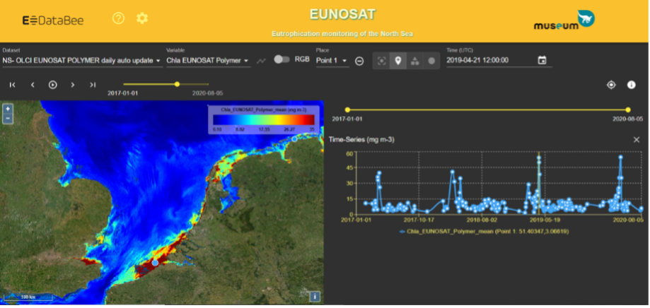
The Eutrophication monitoring service aims at the provision quality-controlled satellite products to support in the COMP4 eutrophication assessment for regions I (Norwegian Coast), II (North Sea) and III (Celtic Seas).
EODataBee has the request to produce chlorophyll maps from satellite observations using the JMP-EUNOSAT processor enabling GES assessment for pre-defined zones using national or other GES thresholds and interaction with the satellite data for non-satellite experts.
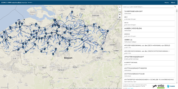
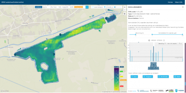
The end user has a wide range of responsibilities in the domains of water, air and environment (e.g. climate adaptation).
To support them with the task of measuring, modelling and reporting surface water quality and water soil quality, we use Sentinel-2 satellite images to produce time series of Chlorophyll-a maps.
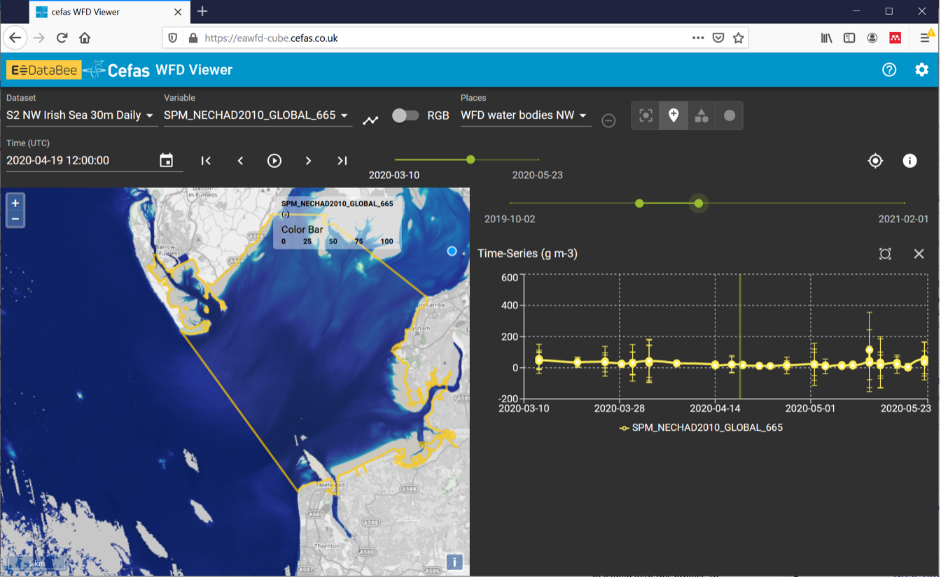
The service aims to provide spatial and temporal robust statistical measures of turbidity and Suspended Particulate Matter as a limiting factor to eutrophication. The user will use these estimates, in conjunction with winter nutrient observations, to predict eutrophication risk in Water Framework Directive coastal water bodies. Up to now only in situ observations of SPM made from EA survey vessels or from the shore were being used. The surveys are monthly but due to cost, are only carried out in water bodies where problems are likely to happen. Additionally, the service also provides Chlorophyll from a non-tuned global algorithm (Gilersonet al. 2010) as a first order approximation, alongside with true-colour RGB for image interpretation.